
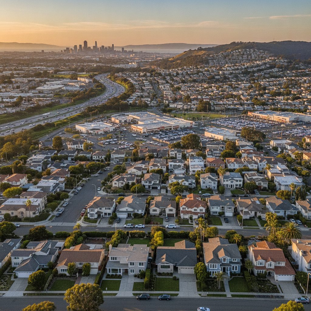
The Architectural Layout and Housing Stock
The physical footprint of Westborough primarily developed during post-war suburban expansions from the late 1960s through the 1980s. Driving through Oakmont Drive, Westborough Boulevard, and the connecting residential avenues reveals a clear mix of architectural forms. Split-level houses, single-story ranch homes, and two-story contemporary layouts sit on modest, well-maintained parcels. Driveways lead into two-car garages, and front yards often display drought-tolerant landscaping alongside mature coastal cypress and pine.In addition to detached single-family dwellings, the area features several planned unit developments, condominiums, and townhome communities. These attached housing options provide accessible entry points into the Peninsula housing market, particularly for first-time buyers looking for proximity to major employment centers. Homeowner associations govern many of the townhome clusters, managing exterior maintenance and shared green belts, while the traditional subdivisions retain individual private ownership without monthly dues.Lot sizes in this section of South San Francisco typically range between 4,000 and 6,000 square feet. This layout provides enough backyard space for outdoor dining, gardening, or small home expansions without demanding excessive upkeep. The topography slopes upward toward Skyline Boulevard, giving several residential blocks clear views across the San Bruno Mountains, the city lights below, or the San Francisco Bay.Commuter Positioning: Highway Access and Public Transit
Transportation efficiency serves as one of the primary drivers of property demand across the neighborhood. Westborough functions as a junction point between multiple major transit arteries, giving drivers direct routes to every corner of the Bay Area.- Interstate 280 runs directly along the eastern boundary of the area, offering a swift route north into downtown San Francisco or south toward Silicon Valley tech campuses.
- Highway 101 sits just a few minutes east via Westborough Boulevard or Hickey Boulevard, linking commuters to the biotech corridor at Oyster Point and San Francisco International Airport.
- Skyline Boulevard (California State Route 35) borders the western ridge, providing a direct, scenic connection south through San Mateo County or west into Pacifica.
- The South San Francisco BART Station and the Colma BART Station sit within a short drive, providing reliable rail transit for commuters avoiding freeway traffic.
Everyday Amenities, Retail Hubs, and Dining
A common frustration in suburban settings is having to drive long distances for groceries or fuel. Westborough avoids this friction by featuring self-contained retail centers integrated directly into its main traffic corridors. The concentration of commercial hubs along Westborough Boulevard and Gellert Boulevard ensures that daily errands take only minutes.Westborough Square serves as the primary commercial anchor. This busy center houses major specialty grocers, including Seafood City, alongside banks, bakeries, medical offices, and casual dining spots. Multiple gas stations flank the main thoroughfares, eliminating the need to search for fuel before starting a morning commute. Down the road on Gellert Boulevard, additional supermarkets, pharmacies, and hardware suppliers expand the retail perimeter.The local dining scene offers an eclectic range of regional and international culinary choices. Within a single shopping plaza or along adjacent blocks, visitors can choose between traditional bakeries, dim sum parlors, ramen shops, Hawaiian barbecue, and classic American diners. This concentration of dining choices regularly draws visitors from neighboring Daly City and San Bruno, yet it functions as an everyday convenience for locals living along streets like Oakmont Drive.Microclimate: The San Francisco Peninsula Coastal Zone
The Bay Area is recognized for distinct microclimates, where temperatures shift across short distances. Westborough sits in a temperate sweet spot influenced by marine air pushing through the San Bruno Gap.The local climate stays mild year-round. It avoids the intense summer heat waves that routinely push past 90 degrees in the South Bay and East Bay, rarely climbing beyond the mid-70s even during peak summer months. At the same time, the neighborhood does not experience the sharp chills seen in higher coastal mountain passes. Winter daytime temperatures generally settle in the mid-50s, while summer afternoons bring fresh coastal breezes that naturally cool homes without requiring heavy air conditioning use.Morning fog frequently gathers over the Skyline ridge during July and August, burning off by midday to reveal clear blue skies before returning in the evening. For many property owners, this moderate weather pattern represents an ideal balance, cutting down on utility cooling costs while maintaining comfortable conditions for outdoor recreation across all four seasons.Parks, Recreation, and Public Infrastructure
Public green spaces form an essential part of daily life in Westborough. Runners, dog owners, and families benefit from several parks scattered through the subdivision grid, each offering distinct recreational amenities.- Westborough Park: Located on Westborough Boulevard, this expansive space features lighted tennis courts, basketball courts, a children's play structure, picnic areas, and the Westborough Recreation Building for community gatherings.
- Sellick Park: Located on Appian Way, Sellick Park provides wide grassy lawns, baseball diamonds, and an open setting for morning walks and casual sports.
- California Park and neighborhood greenways: Linear paths and smaller municipal open spaces give residents immediate options for short walks without leaving residential blocks.